1. Basemaps
You can define up to 8 Base Maps of your choice.
Base Map 1 is always converted into Grey Scale before being displayed.
Default Base Maps are listed below.
1. Grey Scale of Standard Base Map
Worldwide
Copyright: OpenStreetMap
Native Zoom Level: 19
Maximum Zoom Level: 23
2. Standard Base Map
Worldwide
Copyright: OpenStreetMap
Native Zoom Level: 19
Maximum Zoom Level: 23
3. Transport Base Map
Worldwide
Map Copyright: Thunderforest
Data Copyright: OpenStreetMap
Native Zoom Level: 22
Maximum Zoom Level: 23
4. Outdoors Base Map
Worldwide
Map Copyright: Thunderforest
Data Copyright: OpenStreetMap
Native Zoom Level: 22
Maximum Zoom Level: 23
5. Imagery Base Map
Worldwide
Copyright: Esri -- Source: Esri, i-cubed, USDA, USGS, AEX, GeoEye, Getmapping, Aerogrid, IGN, IGP, UPR-EGP, and the GIS User Community
Native Zoom Level: 19
Maximum Zoom Level: 23
6. Cycle Base Map
Worldwide
Map Copyright: OpenStreetMap
Data Copyright: CyclOSM
Native Zoom Level: 20
Maximum Zoom Level: 23
7. NSWImagery Base Map
New South Wales Australia only
Copyright: NSW Spatial Services
Native Zoom Level: 21
Maximum Zoom Level: 23
8. NSWBase Base Map
New South Wales Australia only
Copyright: NSW Spatial Services
Native Zoom Level: 19
Maximum Zoom Level: 23
1.1. Basemap Processing
Grey Scale
To give you a light coloured Base Map where features on top of it can stand out prominently from it, we have include on-the-fly grey scale conversion for one of your Base Map.
The first Base Map, Base Map 1 is always converted to Grey Scale before being displayed.
If you want to see a colour version of it, just define it again in one of the other 7 Base Maps.
Automatic Zoom
Different Native Zoom levels across all basemaps are automatically boosted to the same Maximum Zoom level 23.
So all maps can now go zoom down to metres.
1.2. Basemap Quality
Most Basemaps are based on OpenStreetMap so you can edit them by simply clicking the "Edit" on the https://www.openstreetmap.org/ web site.
OpenStreetMap allows users to update the maps themselves at any time, so they can be more current than Cloud Maps which have to go through a single entity.
1.2.1. Freshness Quality
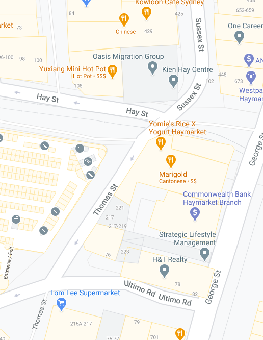
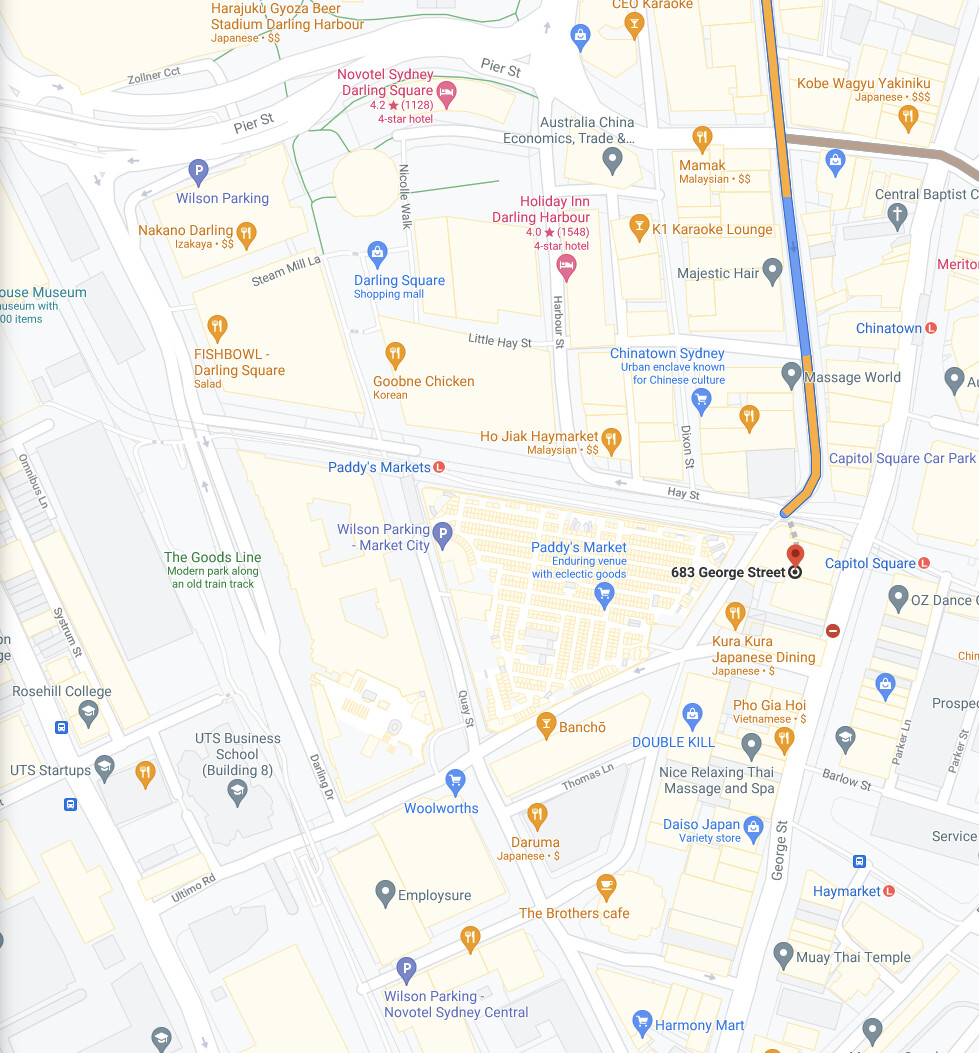
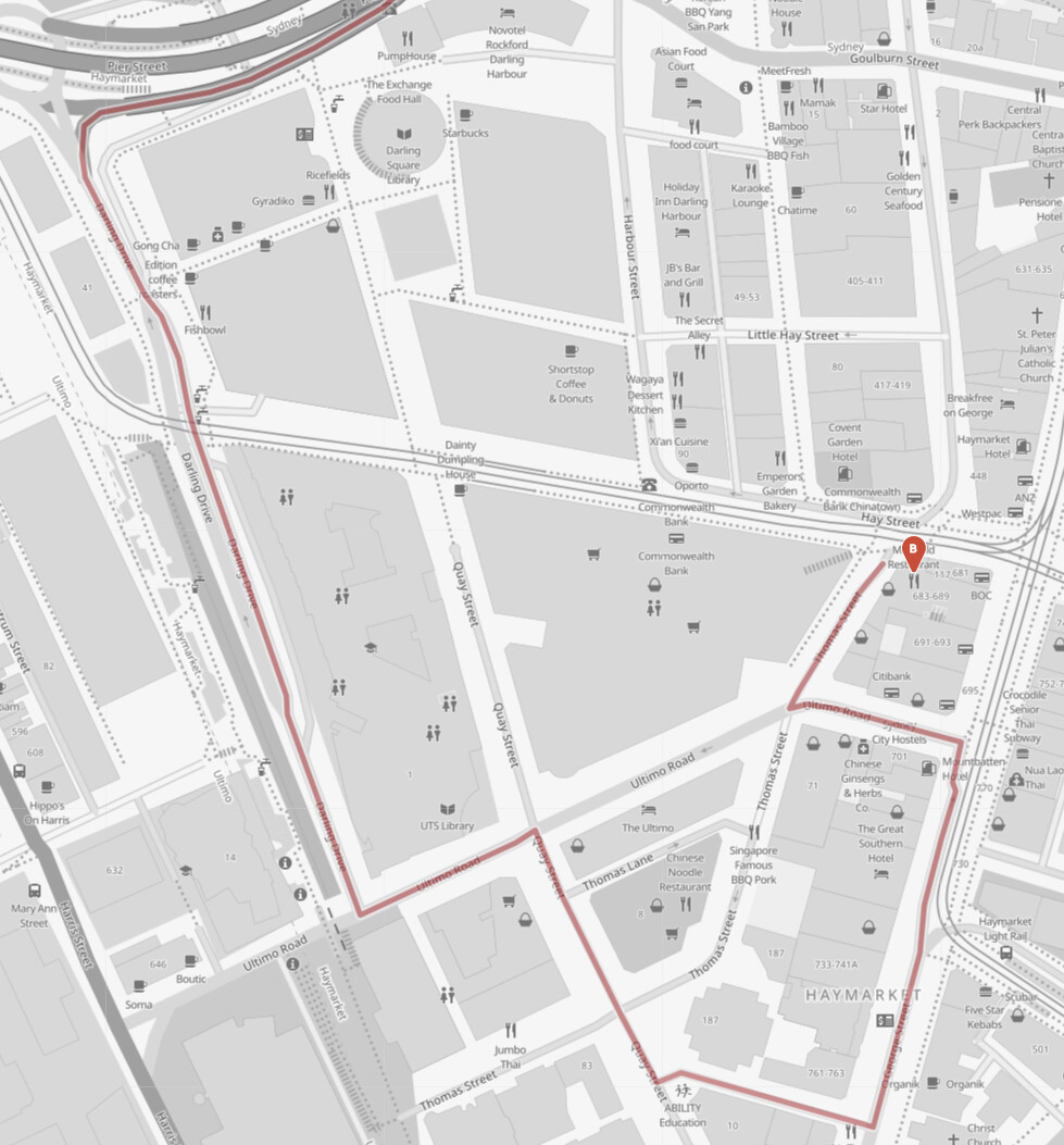
Below are two map images taken on 16-Feb-2021 (Sydney Australia time) showing the intersection between Thomas Street and Hay Street in Sydney, Australia.
The above is from https://www.google.com/maps
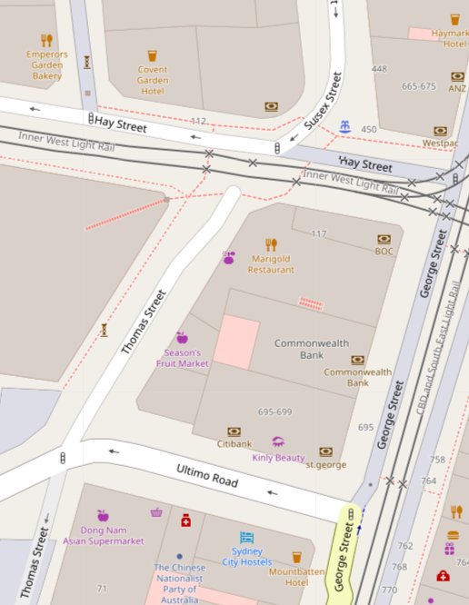
The above is from https://www.openstreetmap.org
As can be seen OpenStreetMap correctly reflected the blocking off of Thomas Street while Google Map was showing the wrong information.
1.2.2. Image Quality
Governments provide high quality maps for free to its citizens in a lot of cases. For example, we are using the free maps from New South Wales (Australia).
Below are two map images showing the SAME car park area in Sydney.
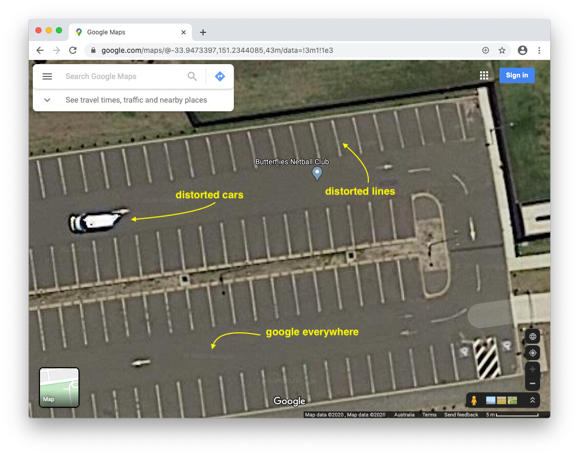
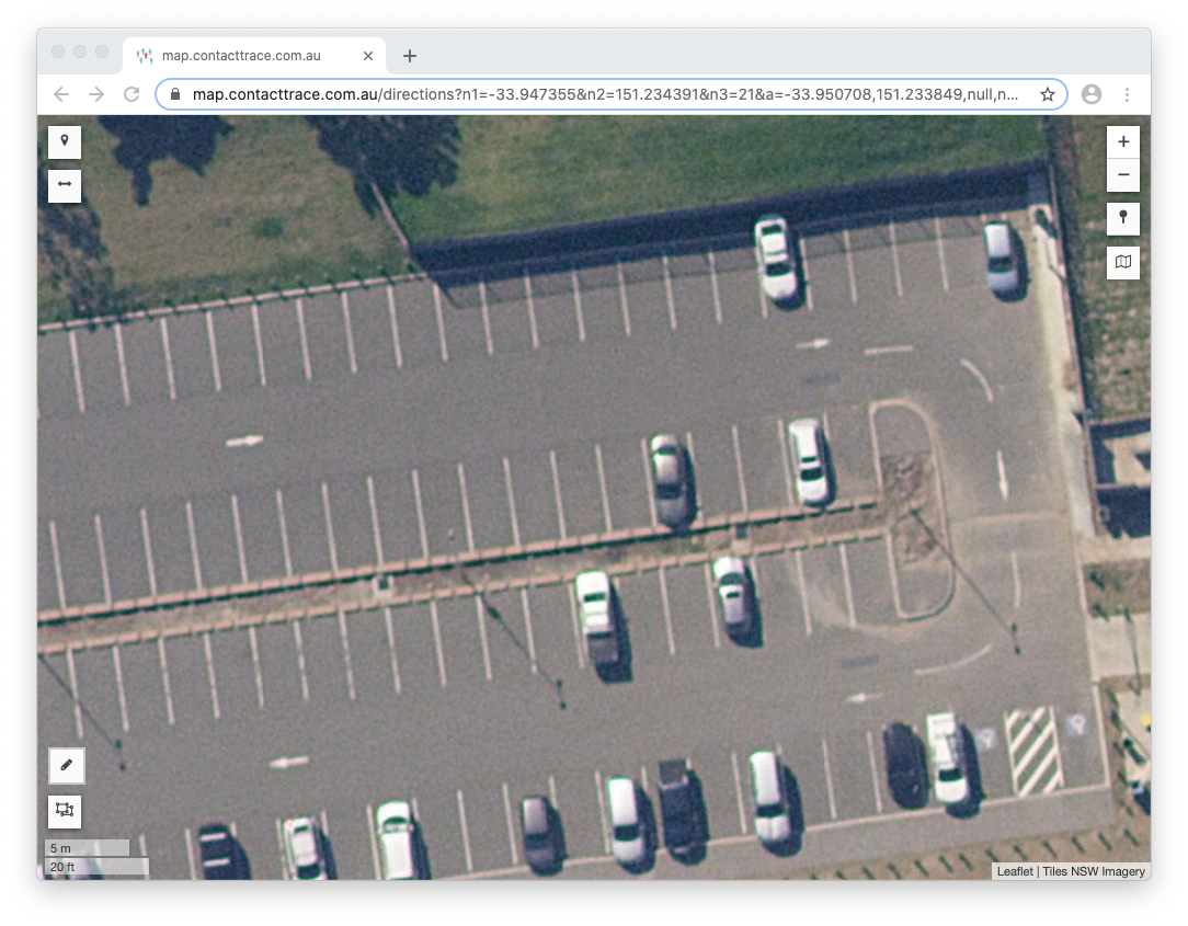
As marked on the Google's map above, the NSW Maps do not have any usage costs, copyright messages and image distortions.
1.2.3. Route Quality
Below are two map images taken on 18-Jun-2021 (Sydney Australia time) showing the suggested routes by https://www.google.com/maps vs https://map.contacttrace.com.au for a car trip from north of Sydney to the Citymark Building near the centre of Sydney.
Google Map ignored the presence of the in-building car park (with car park entrance on Thomas Street) and told the driver to drop people off on Hay Street and get them to walk across tram tracks, instead of leading them to the correct Thomas Street or George Street that the Citymark Building is actually on!
Our own map.contacttrace.com.au correctly finds the route to the entrance of the building car park.
2. Address Format
Minimum Information:
- HouseNumber
- Street
- Postcode
- Country
Standard Information:
- Name
- Level
- City
- State
Optional Information:
5. Email
6. Phone
7. Website
Print Order:
Name, Level, HouseNumber, Street, City, State, Postcode, Country