1. GNSS
Global Navigation Satellite System (GNSS) provides reliable positioning when outdoors.
Above counts operational satellites as of 2025-08-01
Need at least 4 satellites to give you latitude, longitude, altitude and time.
- Get unobstructed view of sky
- Get as many satellites a possible
Multiple Frequency
All GNSS support multiple frequency bands:
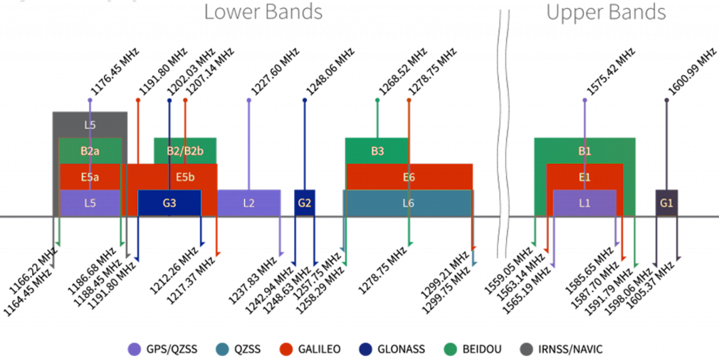
source: maxtena
All GNSS operate at higher frequencies (1164 MHz and above) than the LoRa device frequencies (928 MHz and below) that Team Compute use to complement them.
Phone Support
For high precision get a phone with Dual Frequency GNSS support (e.g. high end Samsung and Huawei phones).
- Galileo Hits the Spot: Testing GNSS Dual Frequency with Smartphones - Inside GNSS - Global Navigation Satellite Systems Engineering, Policy, and Design
- GNSS code and carrier phase observations of a Huawei P30 smartphone: quality assessment and centimeter-accurate positioning | GPS Solutions | Springer Nature Link